Sunday 26 February 2012

No. 11: Nev Cole Way


Named after the founder of The Wanderlust Rambling Club, The Nev Cole Way starts from Burton-upon-Strather in the far north of Lincolnshire. Following the Jurassic scarp overlooking the River Trent, it continues east along the south bank of the Humber. After skirting the highly industrial towns of North / South Killingholme, Immingham and Grimsby, it turns inland into the gently sloping Lincolnshire Wolds and finishes in Nettleton, where it provides a link with The Viking Way.


Saturday 26th February, 57 miles


Apprehensive at the start in Burton-upon-Strather.


Respects to a Lincolnshire rambling legend.


First views of the River Trent from The Cliff.


Green trees.


Marking the way.


Julian's Bower, an ancient maze at Alkborough.


Wetlands where the Trent joins the Humber.


Passing through Whitton.


Buoy, Pudding Pie Sands.


A river of reeds.


Two men in a boat (on dry land.)


Moorings at Ferriby Sluice.


First signs of spring.


Shore.


Approaching the Humber Bridge, until recently the world's longest single-span suspension bridge.


Under the bridge.


Back here soon.


Water's Edge Country Park, Barton.


Silos, New Holland.


Shipwrecked.


North sea ferries on the north shore.


H(e)aven.


Approaching Skitter Ness.


Looking east. Grimbsy's Dock Tower visible in the distance.


Warning Gas Main.


Across the North Sea.


Loading container ships at North Killingholme jetties.


Refining oil.


 Pit stop with the crew at North Killingholme village.


Hope :]


Climbing the stairway to Immingham.


Shabby.


Late afternoon track between Stallingborough and Healing.


The National Grid.


Farm road to Beelsby.


Bowing out.


Sunset 1.


Sunset 2.


Sunset 3.


Sunset 4.


The moon and the stars were the gifts you gave.


Crop experiments, Rothwell.


Flip-flop Crossroads tells me the end is near.


Climbing the Nev Cole Memorial Stile to end the route at Nettleton.


Thanks Nev.


Saturday 18 February 2012

No.10: Silver Lincs Way


Linking Grimsby and Louth, this rural route celebrates the Silver Jubilee of the Grimsby / Louth group of The Ramblers' Association.
Starting from the roundabout in Scartho, on the edge of Grimsby, the route uses surprisingly pleasant field paths and tracks to Barnoldby-le-Beck, Brigsley and Ashby-cum-Fenby, before hitting higher ground at East Ravendale.
A beautiful, undulating route leads south from here towards Louth, where the run finishes at the famous town-centre church.


Saturday 18th February, 25 miles


A less than promising start at Scartho.


More like it. Track skirting Bradley Gairs.


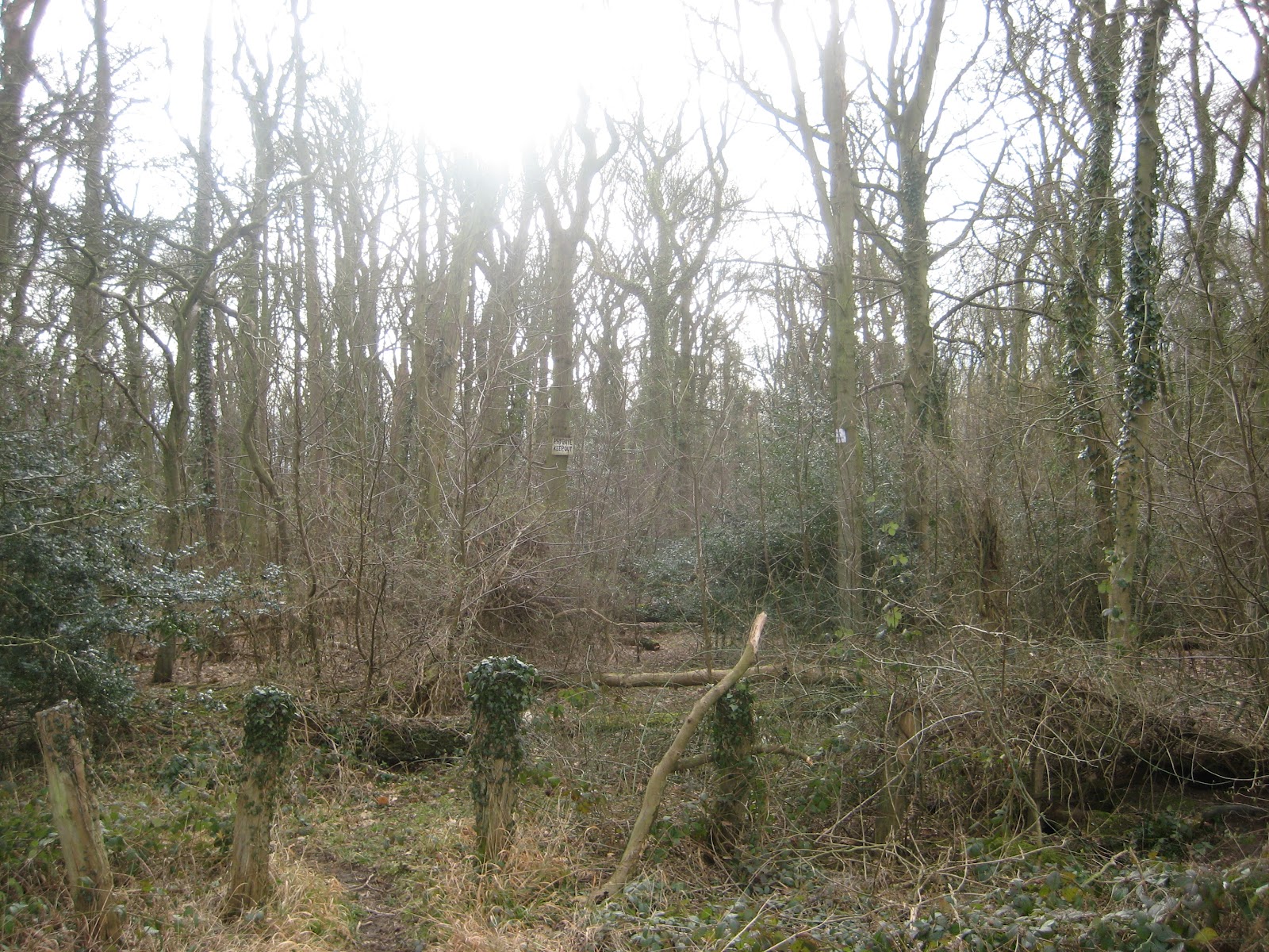
The beautiful mess of nature.


Good running at Bedlam Hill.


Striding out towards Brigsley.


Quiet tracks towards Ashby-cum-Fenby.


Against the sky.


New Waltham windmill.


Extremely Loud and Incredibly Close.


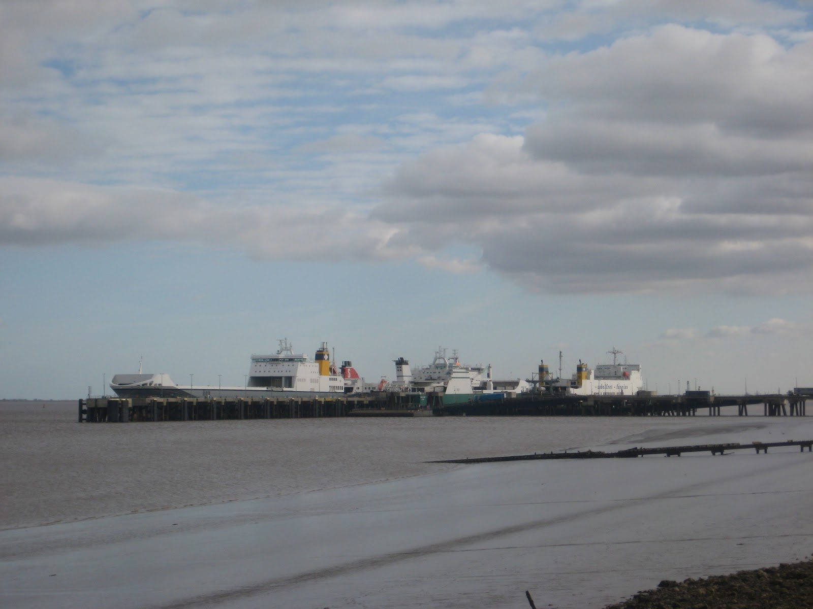
Climbing to the A18 - Grimsby's Dock Tower in the far distance.


Strong winds and rain call for action at East Ravendale.


Spoilt for choice.


Snowdrops in Wold Newton.


Woodland stardust.


Through The Valley to Beesby Top.


Shetland Ponies in Beesby.


Puddle.


Taking a battering in the weather.


Layers.


Long road past Utterby.


Rolling hills, Wyham.


Container ships on the horizon.


Up the hill to the summer sky.


Smirk.


Turn left at the little house, Welton-le-Wold.


Catalogue Pose Mk. One : Leaning against the fireplace, lost in contemplation


Stencil.


Catalogue Pose Mk. Two: Hiking in the woods, relaxed but sporty.


Inspired on the climb up Jack's Furze.


Perfect Day.


North Sea wind turbines.


Along the bottom path, Hubbard's Hills.


The White Cliffs of Louth.


Almost done.


Finished.


Another random glove.


Leon...done!


Chris...done!